


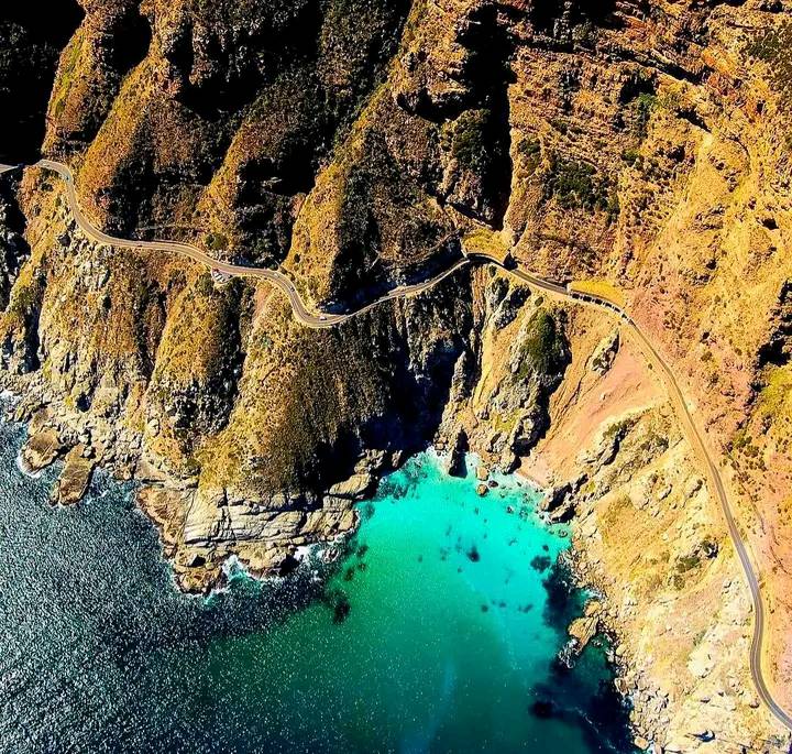


Chapman’s Peak Drive or Chappies is one of the world’s most scenic routes and features in international ads. This drive is one of Cape Town’s highlights.
The drive is 9kms (5.6mi) long and stretches from Hout Bay to Noordhoek along the Atlantic coast. There are 114 curves! On the one side is an impenetrable wall of rock and on the other, a nearly vertical cliff that drops 100 metres to the sea. You will drive through a protected section as rocks can tumble from the cliff here.
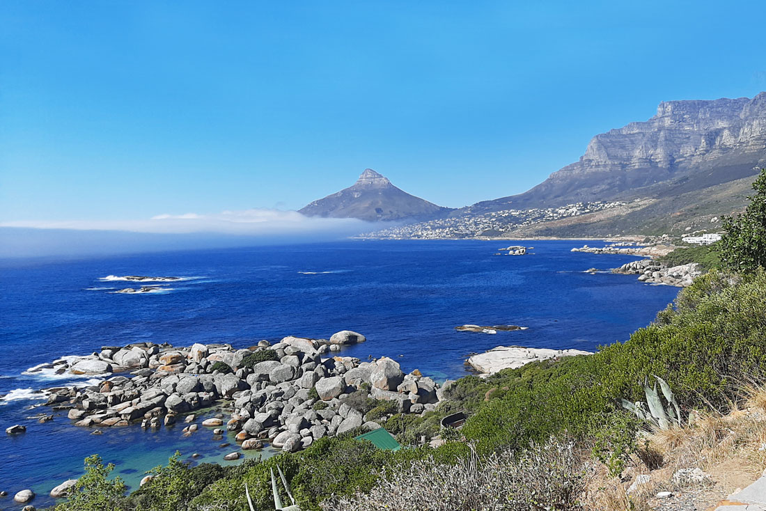
There are viewpoints and photo stops along the way with stunning views of the fishing village of Hout Bay, the Sentinal Peak, beautiful seascapes and at the end, the endless white sands of Noordhoek beach.
Baboons: Please respect the wildlife, often at the viewpoints. DO NOT feed, or mimic these wild animals as they are unpredictable. We also suggest closing your car doors when you get out as baboons are curious and can enter the car… just in case you have some food inside!
The route is open 24 hours a day, every day. However, in extreme weather, when maintenance work, conservation work on the mountain is needed, The Cape Town Cycle Tour , 2 Oceans Marathon, or if smoke causes visibility problems, the road may be closed. This is a road that requires regular maintenance and so it is a toll road in both directions with tariffs that change.
A Day Pass/Picnic Pass is available for daylight hours and gives cheaper access to some picnic points and start of hikes, with parking places. There is an old fort at one picnic spot.
For all updates or any changes always check the website first www.chapmanspeakdrive.co.za
History: Chapman’s Peak is named after John Chapman, the Captain’s mate of an English ship. In 1607 the skipper of the British ship Contest found his vessel becalmed in what is now Hout Bay and sent his pilot, John Chapman, to row ashore to find provisions. The pilot later recorded the bay as Chapman’s Chaunce (chance) and the name stuck.
In the early 1920’s Sir Nicolas Fredrick de Waal, first administrator of the Cape Province, called for a road linking Hout Bay to Noordhoek as an alternative to recently built De Waal Drive.
In 1914 preliminary surveys on the road got under way. Surveying the route was a scary business. The cliffs and ravines were steep, rotten and unstable, and at times the surveying party was on all fours as they investigated the perpendicular terrain. It appeared to be expensive and a ‘mission impossible’. De Waal however, would not take no for an answer and eventually he ordered the ‘go’.
In 1915, with the use of convict labour work began from each side. This spectacular roadway took seven years to complete, at a cost of ₤20 000. The Hout Bay – NoordHoek Road ‘hewn out of the stone face of Sheer Mountain’ was opened to traffic in 1922.
In 1977 a portion of road was washed away, and the damaged section was replaced by a bridge at a cost of R150 000. Net fences were erected to stop rock falls in the late 1980s.

 1 Chapmans Peak Dr, Hout Bay, ...
 35 Main Rd, Hout Bay, Cape Tow...
 Chapmans Peak Dr, Hout Bay, 78...


